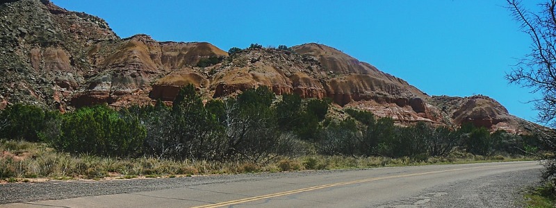
Facts about this picturesque stretch of America’s Highway
Although most of Route 66 has been bypassed by the interstate, some of the scenic transcontinental roads still exist. The longest continuous stretch runs through Arizona.
US Highway 66, also known as Route 66, was commissioned in 1926. The highway traversed eight states – Illinois, Missouri, Kansas, Oklahoma, Texas, New Mexico, Arizona, and California – and three time zones. The total length of the highway was 2448 miles, from Chicago to Los Angeles.
Route 66 had many uses. During the Great Depression, Route 66 was the primary road used by families escaping the drought of the Midwest and going to California to explore new opportunities. Such a flight was chronicled by John Steinbeck in his book The Grapes of Wrath. It was in this book that Route 66 was first called The Mother Road. In the 1940s, Route 66 was used by the military during World War II to move troops and equipment since it was the only fully paved East to West road in existence at the time. Once the war ended, families once again took to the road, traveling along America’s Highway on pleasure trips.
In the mid-1950s, President Eisenhower signed the Federal Aid Highway Act of 1956, which allowed a national highway system to be built. Bigger and better roads than Route 66 were planned and constructed and much of Route 66 began to be bypassed by interstates.
Route 66 was officially decommissioned in 1984, although travel along the historic road had been declining for quite some time. Portions of Route 66 do still exist today, however. The longest continuous stretch runs 165 miles through Arizona, from just east of Ashfork heading west to the California border. Here are some other facts about Arizona’s portion of The Mother Road.
Arizona Route 66 Trivia
- Flagstaff is the highest spot of any city of all of Route 66, at 7000 feet elevation.
- Williams is known as the Gateway to the Grand Canyon.
- Flagstaff was the first Arizona town on Route 66 to be bypassed by Interstate 40, in 1968.
- Williams was the last Arizona town to be bypassed, in 1984.
- The Historic Route 66 Association in Arizona was created in Seligman in 1987 by barber Angel Delgadillo.
- The Delgadillo family also owns the Snowcap Drive-In restaurant in Seligman.
- Winslow Arizona is immortalized in the 1972 Eagles’ hit Take It Easy. There is a park dedicated to the song, Standin’ on the Corner park.
- Arizona’s portion of Route 66 passes through two Native American Indian reservations, the Navajo reservation in Eastern Arizona, and the Hualapai reservation in the West. It also passes near the Hopi reservation.
- Route 66 also passes through or near several natural and historic wonders, making the Arizona road one of the most picturesque portions of Route 66. Some of the sites within driving distance from Route 66 are the Petrified Forest, Walnut Canyon, Sunset Crater Volcano, Meteor Crater, Grand Canyon Caverns, and the Grand Canyon.
- When Route 66 was in its heyday, small towns flourished along the road. Now, many of these towns no longer exist. At least five of the smaller Arizona towns do still exist today as ‘living ghost towns’. These towns are White Hills, Truxton, Hackberry, Valentine, and Oatman.
- Kingman is the largest Arizona town that exists along the 165 miles continuous stretch of Route 66.
- Arizona has one of the most dangerous sections of all of Route 66, from Kingman to Oatman through the Black Mountains. This road is a series of narrow, hairpin turns. This section was bypassed in 1951 in one of the many realignments of Route 66.

